🌪️ Helicopter Role in Sandstorm Research – 6 Powerful Contributions to Desert Climate Science
Helicopter role in sandstorm research includes real-time dust data, airborne sensors, and terrain analysis. DreamSafar.in reveals 6 powerful ways helicopters support desert science.
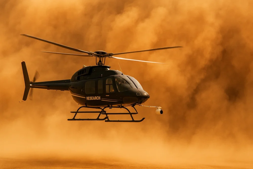
🚁 Helicopter Role in Sandstorm Research – Flying Labs in India’s Desert Skies
Sandstorms are among the most unpredictable and dangerous atmospheric events, especially across India’s Thar Desert, Rann of Kutch, and arid zones of Ladakh. Understanding them is critical for disaster preparedness, aviation safety, and climate modeling. The helicopter role in sandstorm research has emerged as a game-changer—offering high-speed, low-altitude platforms for real-time data collection and mobile sensing.
In this article, DreamSafar.in highlights 6 powerful ways helicopters contribute to sandstorm research, supporting scientists and meteorologists in decoding desert dynamics.
🌫️ 1. Real-Time Airborne Dust Monitoring
Helicopters fly through or along the edge of sandstorms to:
-
Measure particulate matter (PM10, PM2.5)
-
Track dust density, particle size, and height
-
Monitor aerosol content and optical depth
✅ Helicopter role in sandstorm research provides real-time vertical profiles not possible with ground stations
📡 2. Deployment of Dust and Weather Sensors
Helicopters can carry or drop:
-
Dust samplers and air quality probes
-
Micro-meteorological sensors (wind speed, direction, pressure)
-
LIDAR and aerosol spectrometers
✅ Enables atmospheric scientists to analyze dust chemistry, origin, and movement
🛰️ 3. Satellite Calibration and Ground Truth Validation
Helicopters help:
-
Calibrate satellite images from INSAT, MODIS, or Sentinel
-
Confirm aerosol optical thickness (AOT) readings
-
Validate cloud/dust overlays with real-world GPS-tagged visuals
✅ Ensures more accurate sandstorm modeling and forecasting systems
🧭 4. Terrain and Source Zone Mapping
Sandstorms originate from:
-
Dry riverbeds
-
Overgrazed lands
-
Desertified farmland
Helicopters:
-
Identify new dust source zones
-
Capture multi-angle terrain imagery
-
Support desertification risk mapping
✅ Vital for dust control planning and early warning alerts
🧪 5. Data Collection During Pre- and Post-Storm Phases
Before a storm:
-
Helicopters detect temperature and pressure shifts
-
Analyze dust lofting patterns
After a storm:
-
Assess soil erosion, crop damage, and visibility loss
-
Help determine health impacts on nearby populations
✅ Helicopter role in sandstorm research allows continuous timeline observation
🛟 6. Emergency Support and Public Alert Verification
Helicopters also aid in:
-
Aerial warning announcements in desert villages
-
Rescue missions during zero-visibility storm events
-
Media documentation of sandstorm severity
✅ Adds a public safety layer to scientific sandstorm research operations
📊 Cost Estimate – Helicopter-Based Sandstorm Research
| Activity | Estimated Cost (INR) |
|---|---|
| Dust Sampling Flight (1 hour) | ₹1.5 – ₹2.5 lakh |
| LIDAR Mapping & Data Collection | ₹2 – ₹4 lakh/hour |
| Satellite Cross-Validation Mission | ₹75,000 – ₹1.2 lakh/hour |
| Full Research Deployment (monthly) | ₹25 – ₹45 lakh |
✅ Often funded by IMD, ISRO, CSIR–NEERI, and international desert climate initiatives
🗺️ Indian Regions Using Helicopter Support for Sandstorm Research
| Region | Application Area |
|---|---|
| Thar Desert (Rajasthan) | PM10 dust profiling and air quality studies |
| Rann of Kutch (Gujarat) | Terrain source mapping and sensor deployment |
| Ladakh Cold Desert | Dust movement in high-altitude basins |
| Bundelkhand Semi-Arid Zone | Desertification impact monitoring |
❓ FAQ – Helicopter Role in Sandstorm Research
❓ Are helicopters safe to fly near sandstorms?
Yes, with experienced pilots and weather-resistant navigation systems, helicopters can safely operate on storm peripheries or within controlled zones.
❓ Which organizations manage such missions in India?
-
IMD (India Meteorological Department)
-
ISRO (for satellite model validation)
-
CSIR–NEERI
-
DRDO (for defense-related visibility studies)
❓ Is sandstorm research publicly accessible?
Yes, much of the data is used in public weather alerts, disaster preparedness manuals, and academic research.
🔗 Useful Links – DreamSafar.in
🌐 Resources
🏷️ Tags
helicopter role in sandstorm research, DreamSafar.in, dust monitoring helicopter India, airborne aerosol study, sandstorm climate science, helicopter meteorology support

